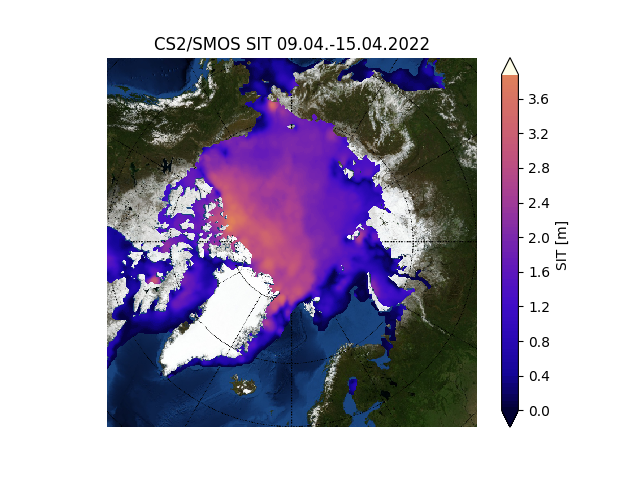
CS2/SMOS NRT Sea-Ice thickness
Sea ice thickness (SIT) is calculated by merging Cryosat-2 altimeter and Soil Moisture and Ocean Salinity (SMOS) radiometer measurements. The combination of both datasets is based on an algorithm developed at the Alfred Wegener Institute. It uses a statistical approach (optimal interpolation), which merges weekly information from CryoSat-2 and SMOS based on the respective uncertainties for different thickness classes. The product contains the sea ice thickness for each calendar week on the 25 km EASE2 Grid.
The latest product data is also available here:
W_XX_ESA_SMOS_CS2_NH_25KM_EASE2_20220410_20220416_o_v204_01_l4sit.nc